A bit about Bukit Tabur East, it is located along Taman Malawati nearby Wangsa Maju in Kuala Lumpur. On an average you will need about 1 1/2 to 3 hours depending on each individual groups stamina level. Bukit Tabur East is a lesser known trail of Bukit Tabur compare to its more popular Bukit Tabur West trail. This is mostly due that Bukit Tabur East is more difficult and more dangerous to climb. In contrast with BT West that you will have gradual climb where the trail is not so steep... BT East trail have more steep incline straight away meters into the trail. Highest peak (fourth peak) of BT East is at 900 feet just around 50 feet higher than BT West.
The type of challenges that Bukit Tabur East provides are very good to start conditioning people that have just started hiking. If you go there in the morning you will be able to enjoy the excellent morning air. The air that's so refreshing and make you want to go back for more! It’s worth the effort to wake up early in the morning for this.
Early2 pun, it was not early when we all departed from office nearly at 7.20pm. Reached Taman Melawati around 7.45am, parked our car and had a short briefing by our guides that day, Pa'an and Syam.

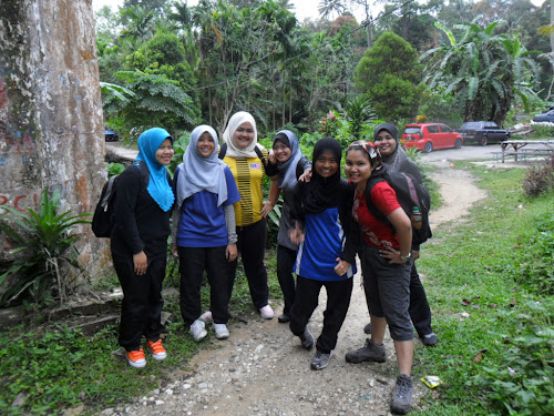
8.00pm we started to hike. Starting Point of Bukit Tabur East at the end of small road along big water pipe.

The place was interesting I have to say, with nice view. There were no leeches or any wild animals ( I didn’t see any). Well it's a quartz ridge and of course very hot for those animal to live in. The beginning of the path was quite easy, but as you go higher up, you have to use the rope to help you up.
Early stage.. cheerful faces...
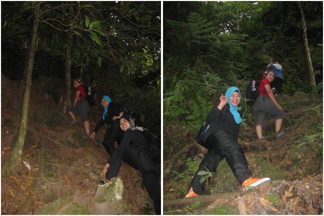
Suka ek mamat kat belakang tu tgk aku tertonggeng2.....
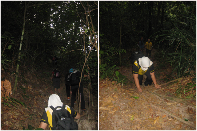
Steep trail up to the first check point. The rope provided for assistance...

Made it to the first CP. Muka dah pucat mcm lepas beranak

Rileks jap...

At the first check point of Bukit Tabur East. They named it Tongkat Ali Point

First View offered a residential area and Bukit Tabur West Ridge on the other side
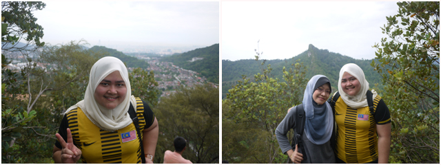
Di sebalik rimbunan pepohon...

Can U see the KLCC... Klang valley view. Walla....

Raw quartz that you will find on the middle of the Bukit Tabur East Trail -


Continue to 2nd check point...

The trail became harder and harder...
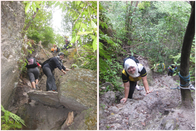
Muka mintak nyawa...

View on the 2nd CP was very captivating. From here we already started to see the view of the Klang Gate Dam...
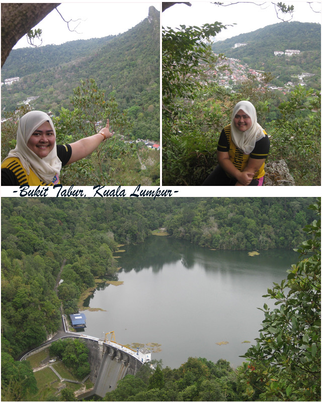
Photos courtesy of Kak Sue Cam...
Guide 1 : Sham

Guide 2 : Pa'an

Follower : ME!!

Mangsa keadaan!!

Along the journey to the 2nd & third point, we met a freelance guide. He was willingly voluntereed himself to guide us and once we reached the third peak, I heard him talking to the other 2 guys that he was not confident to bring us to the last peak. To reach the fourth peak of Bukit Tabur East, hiker has to climb a nearly 80% steep wall. Small rope is fitted there to assist climber but it's already rotten and cannot stand much weight.
A bit about myself, I don't have a problem in hiking through the trail.. I'm used to it and I enjoyed it so much. Well semput skit2 biasalah... my stamina getting lower lately u know. However my biggest problem was the height or "scientifically" called GAYAT. As long I didn't see the cliff, I can focus on the hiking.. but when I saw the real rock wall, I started to remember all the accidents that happened here (of course I did googled about Bukit Tabur before I came) and the freelance guide was not helping. He kept remind us about "not confident", there's a death accident happened... and lastly ayat yg plg x sedap "it depends to you all, if you think you can manage it, then you can climb. I just warned u. Terpulangla..." If you put yourself in my shoes, how would you feel? My stomach started to do a somersault, and my heart beat like a speedboat....
I continued the journey which seems to be more difficult, unforgiving climb.. damn!!

Never the less, pretended to be happy snapping photos at the 3rd peak. U'll be surprised to hear the name.
The 3rd peak is called check point RnR

The views were spectacular....
One side … huge development going on

Reverse side, the virgin nature..

You will be able to view the Klang Gate Reservoir and an ever serene lake throughout the entire hike.

Frankly I envied Dhiya photo here, but I was just scared to stand and pose at the edge of the cliff like her..

Xnak kalah, I took photos at more secure and stable spot. Skali 4 kau..!!!
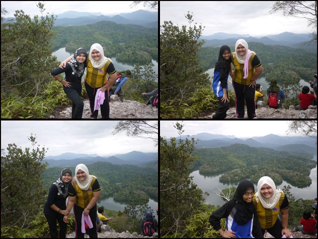
Puas bergambar, we continued to the last peak. My biggest fear and little drama was about to begin.

Depan sana ya adek maneesss.... jgn takut!

"Gondol" tu la target kami!
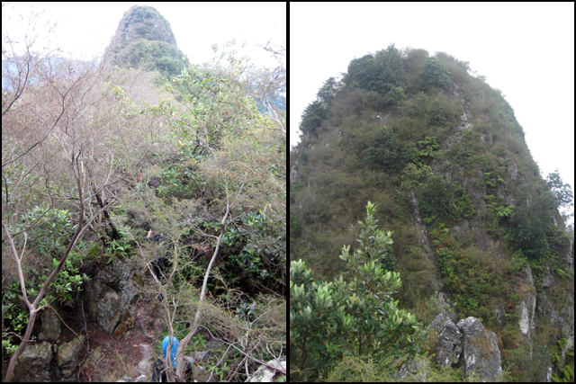
It was when the 80 deg rock wall to the forth peak direcly infront of me, Is the freelance guide asked me to follow him to climb first. Due to the unstable condition of the rocks, we had to climb one by one to avoid the fallen rocks hit the member below. Me who was already demotivated and freaking out suddenly refused to climb with the reason that I was not confident and uncomfortable with my shoes (it was a bit bigger so it kept fell off from my feet). Luckily Is gave me motivation (err.. bukan td ko ke yg ckp x confident bwk kitaorg naik puncak tu..??) then I got my nerve back again so I followed him to the peak. Following my back was Syam in case I slipped so he could back up. I was focusing hard on each direction Is told me to step into, so it kept me distracted from looking around coz definitely, I would not like what i would see. Lembah2, gaung.. adoi just imagined about it already made me had a goose bump.

Wall Climbing at the Highest Peak of Tabur Hill East

Be prepared for the rugged terrain of sharp rock formations, very steep, drops, balancing on thin ridges & some rock climbing. Any lost grip will face a potential 30m - 100m fall. Gedebushhhh....!!!!
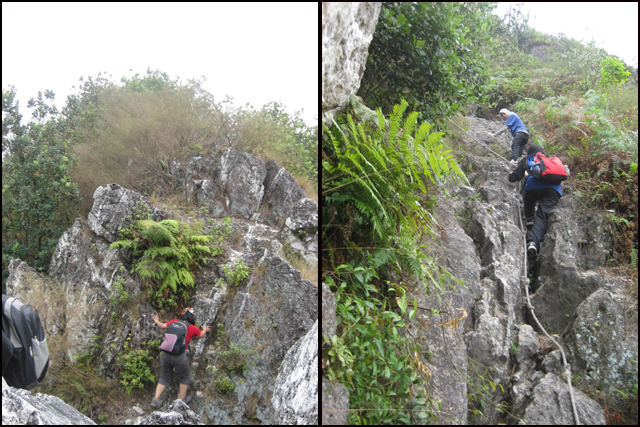
Alhamdullilah berkat keazamanan and prayers (DOA2 ketika ini adalah sgt diperlukan), I succesfully reached the 4th peak. The first one plak tu. After yg lain menyusul kejap jer. Nampak sgt I was the one who needed special attention. :P
Mercu tanda kejayaan!!!

View at the top was subhanallah... Luckily the weather was a bit cloudy so it's kindda perfect to rest and open our pot lucks. It was 10.30am, about 2 1/2 hours taken to the top. We had our breakfast here and the surrounding was magnificent. A good spot for group photo too :) Since there were no bushes tree, normal condition could be hot up here with no shade from the sunlight.
Lepak...

Oh my savior... berjasa di kala kehausan yg melampau.

Rehat bermati2an and I was trying hard not to think about our journey back down coz there would be no other trail then the trail that we climbed before. Arrggghhh...
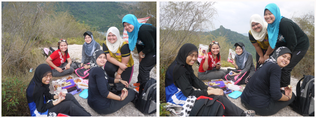
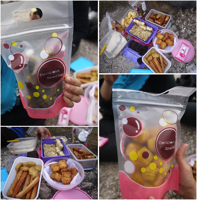
Each person had been assigned earlier by Kak Sue to bring our foods for pot luck. I brought mini muffins and apples. Our breakfast... OH-some!!
Ape2pun kita bergamba sampai lebam dulu!


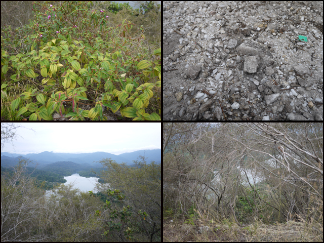
The natures... from left up is "pokok sabun"... katanya bole keluarkan buih. Next, the quartz.. bole amik bikin batu cincin. Bottom left the Dam and next "pokok gunung batu"... daun kurang ranting lebih.
Sssshhhhh........

Did you see what I saw? A boat crossing the lake?

Jalur Gemilang left alone on the top once we headed down...

As expected, on way down, I have difficulties.. finding my steps. It was actually everyone's problem coz the wall was almost 90 deg straight that you could only see the cliff and not the steps. Luckily Is was still around, guided me where to step with my trembling legs. He kept remind me to hold on the rope tightly and I could not more than agree coz there was time when I just 100% relied on the rope as I could not find the steps to put on my feet. I got scratches and bruises from knocking myself against the rocky mountain. I also used my legs and hands to grip and climbed down. I felt like a spiderwoman. Woohoo!!

Anyway, I got down from the mountain in one piece. Still alive. It was fun, I do encourage those who like trekking to try this. But be very careful… there are people who went and died from falling down, so taking extra precaution is advisable. (cite mati lagi...tp xde salahnya beringatkan)
So relief once I saw this sign...

Journey back down we used another route. Is brought us to short cut melalui kebun. Of course a bit far form the previous way to go up but much more easier coz what most important here was to control your leg's "break".
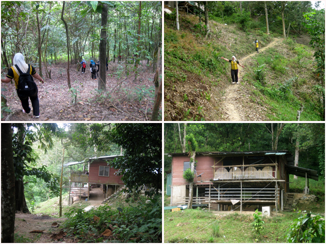
We just slided down but this time I was a bit careless. We already emerged from the forest and I could see the housing area in front of me.

It was a bit menurun bukit at the TAR road when i suddenly slipped, fell off and sprained my ankle.

Luckily dh nak balik and I could still walk. Kalu x naya nk bwk keta amik I kat sini. See, I told you accident could happen anywhere when we careless in just one second of time.

Injured....it was hurt!!

Tapi... dalam sakit2 pun bole lagi post...

Tp gamba lompat2 xde la noks.. mak x larat nk jump!

Limping and secara bersusah payahnya I walked from Bukit Melawati to taman perumahan finally to our car park. Land mark pipe besar tu...
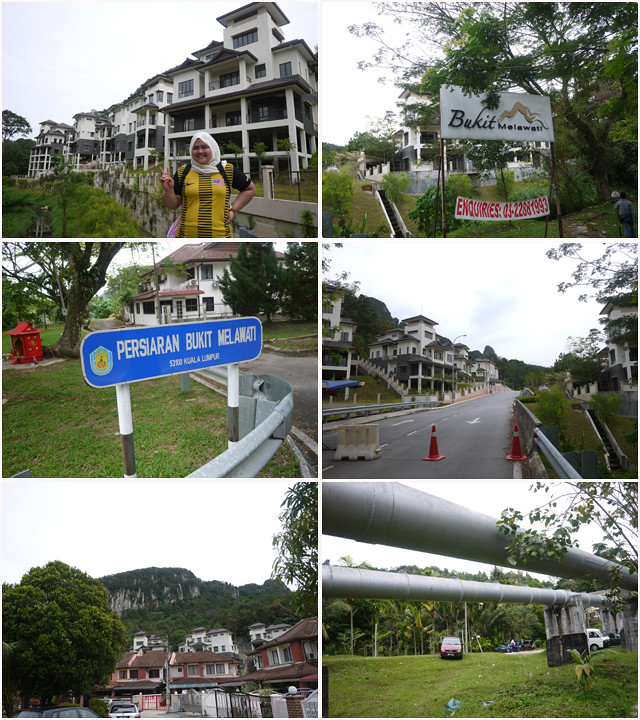
Almost 1pm.... I think we were a bit ahead than estimated time. Chaiyokk!! Kesian my Baby-G yg lemah lembut lunyai kena gasak naik bukit. Kena beli jam baru nampaknya!

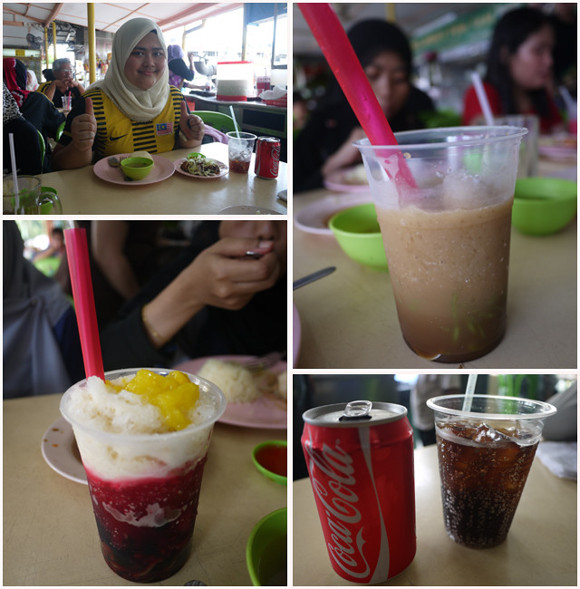
Before dismissed, we went for lunch at Melawati

We all had a chicken rice. The pain of my ankle had spoil my appetite so I cannot comment on the taste. However this restaurant must be famous because it was so packed when we came in. The coke was mine... Cendol & ABC were others but mmg nampak mengoda!
Finally reached home with a "tanda kenangan" brought from Bkt Tabur at my feet. Adoi... hopefully all the marks will dissapear. Klau x ber"sopak" la kaki...
Overall, I would say that my experience was super precious. I never regret even up till now, my ankle still didn't show any sign of recovery. I support those who wish to conquer Tabur's peak and don't forget the safety ok! Hope that you enjoy the hike to Bukit Tabur East as much as I did. EMBRACE NATURE and ENJOY the process people!!
No comments:
Post a Comment